Engineering Geomatics Solutions
SINGLE SOURCE OF TRUTH.
We leverage high-fidelity reality capture and precision structural monitoring to bridge the divide between physical sites and immersive digital twins.
MISSION OF PRECISION
We bridge the gap between traditional land surveying and modern digital twins, providing a "single source of truth" for complex infrastructure projects. Our mission is to empower the construction, rail, and energy sectors with high-accuracy spatial data solutions that drive technical excellence across Ontario and Kenya.
Our Core Competencies
We bridge the gap between traditional land surveying and modern digital twins with precision-grade instrumentation and cutting-edge reality capture technology.
01
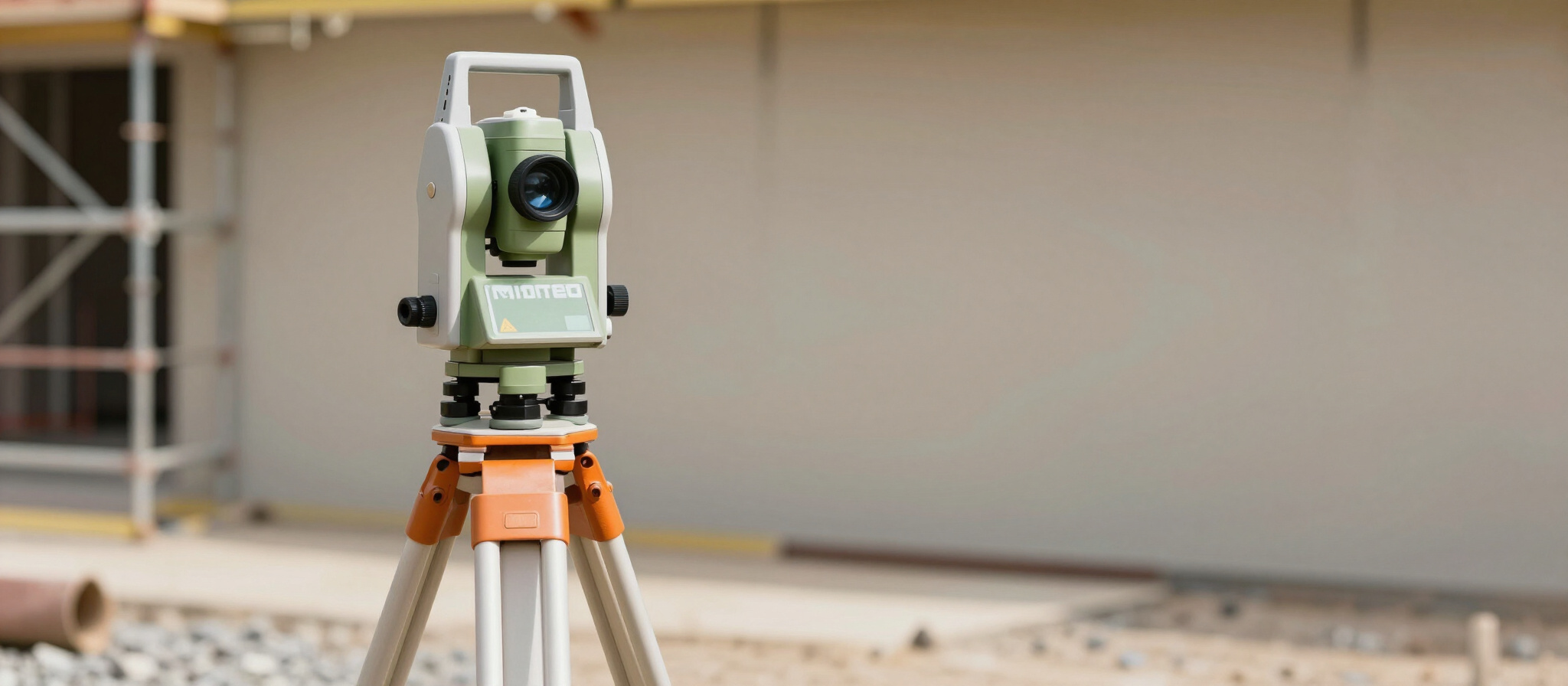
Engineering Surveying
We provide high-precision structural monitoring, rail alignment, and construction layouts. Our services ensure sub-millimeter accuracy for complex infrastructure projects across Ontario.
02
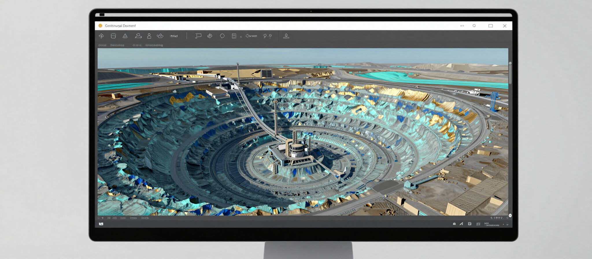
Reality Capture
Using terrestrial LiDAR and Gaussian Splatting, we create photorealistic 3D visualization. Our Scan-to-BIM workflows deliver Revit models from verified geodetic field data.
03
Aerial Geomatics
Our RTK-enabled drone mapping captures topographical contours and volumetric analysis. We deliver specialized terrain modeling for agriculture and infrastructure planning globally.
Engineering the Single Source of Truth
Combining survey-grade instrumentation with cutting-edge reality capture, we deliver high-accuracy spatial data solutions across Ontario and the Kenyan markets. Our advanced tech stack, featuring Trimble R12 GNSS and Leica MS60, ensures industry-leading precision that reduces field errors by up to 25%.
The Precision Tier: Our Technology Stack
We utilize the highest-grade engineering instrumentation to bridge the gap between physical infrastructure and high-fidelity digital twins.


Inquire About Your Next Project
Whether you require high-precision structural monitoring in Ontario or adaptive agricultural mapping in East Africa, our team provides the single source of truth for your infrastructure.
info@kmetrixgeomatics.com
1 (416) 230 0848
Phone
Location
North York, Toronto, ON
Expert Solutions by Industry
We bridge the gap between traditional land surveying and modern digital twins, providing a single source of truth for complex infrastructure projects across Ontario and Kenya.